Gunnerside Gill walk
Rose Atkinson • November 19, 2019
Gunnerside Gill, up on to Reeth Moor, back to Gunnerside6.5 Miles
1946m assentApprox. 3 hoursEasy / Moderate
Yesterday was such a beautiful, crisp winter day I needed to get out into the wild and appreciate all we have around us.
I fancied putting to the test the OS Maps app that we have for our cottage guests to use, but have never actually used myself!
From past experience I knew that we can’t use the app if we have no phone service and that is quite often when we are around and about our beautiful Swaledale. We can, however, download and save maps and routes to use with no signal so with a bit of planning that’s exactly where I started.
Using the app I first searched for routes that other users had uploaded. There’s so many just in Gunnerside but not the route I was intending to explore. I set out my own route. This sounds more technical than it is! A few taps on the screen and the route finder clings to the best paths to use and voila! My walking trail can begin. 6.5 miles to be precise, with 1946m of ascent.
Driving up to Gunnerside to set off for this route I see just how bright the day is. I park up in the village centre and take the footpath up the side of Gunnerside beck, just opposite the pub. I set my app away so that it can follow my progress.
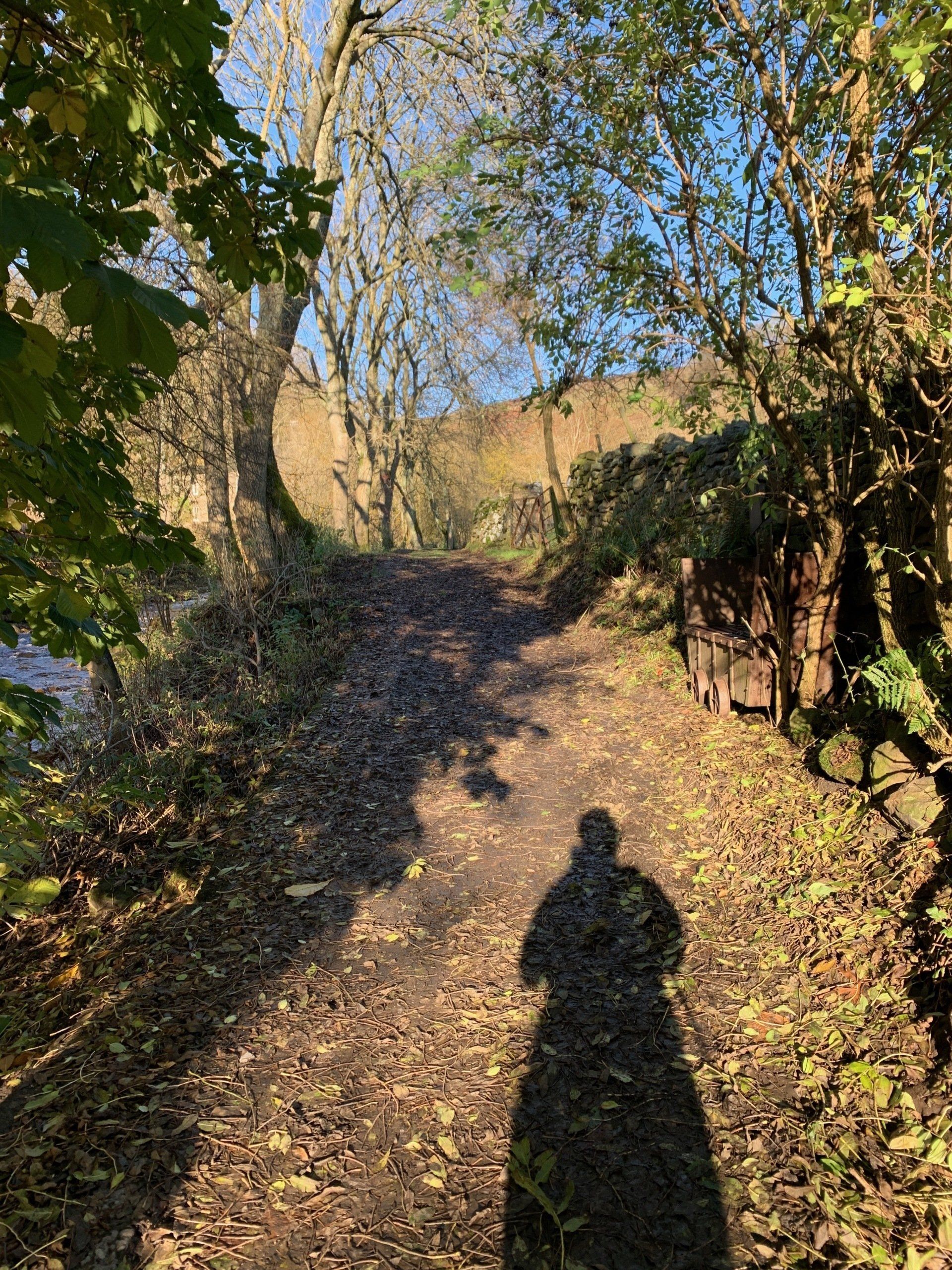
The first few hundred meters is following the beck side in the trees and along muddy, leafy paths. It’s been frosty overnight and the ground isn’t quite thawed out just yet. I love walking at this time of year with all the smells of the woodlands and sound of the beck in full flow.
It’s a very gradual up hill amongst the trees, just enough to let me know how unfit I am! It didn’t seem like much of an incline but my goodness I’m feeling it.
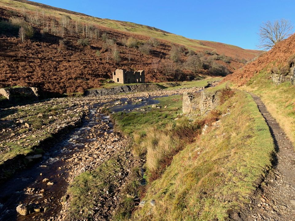
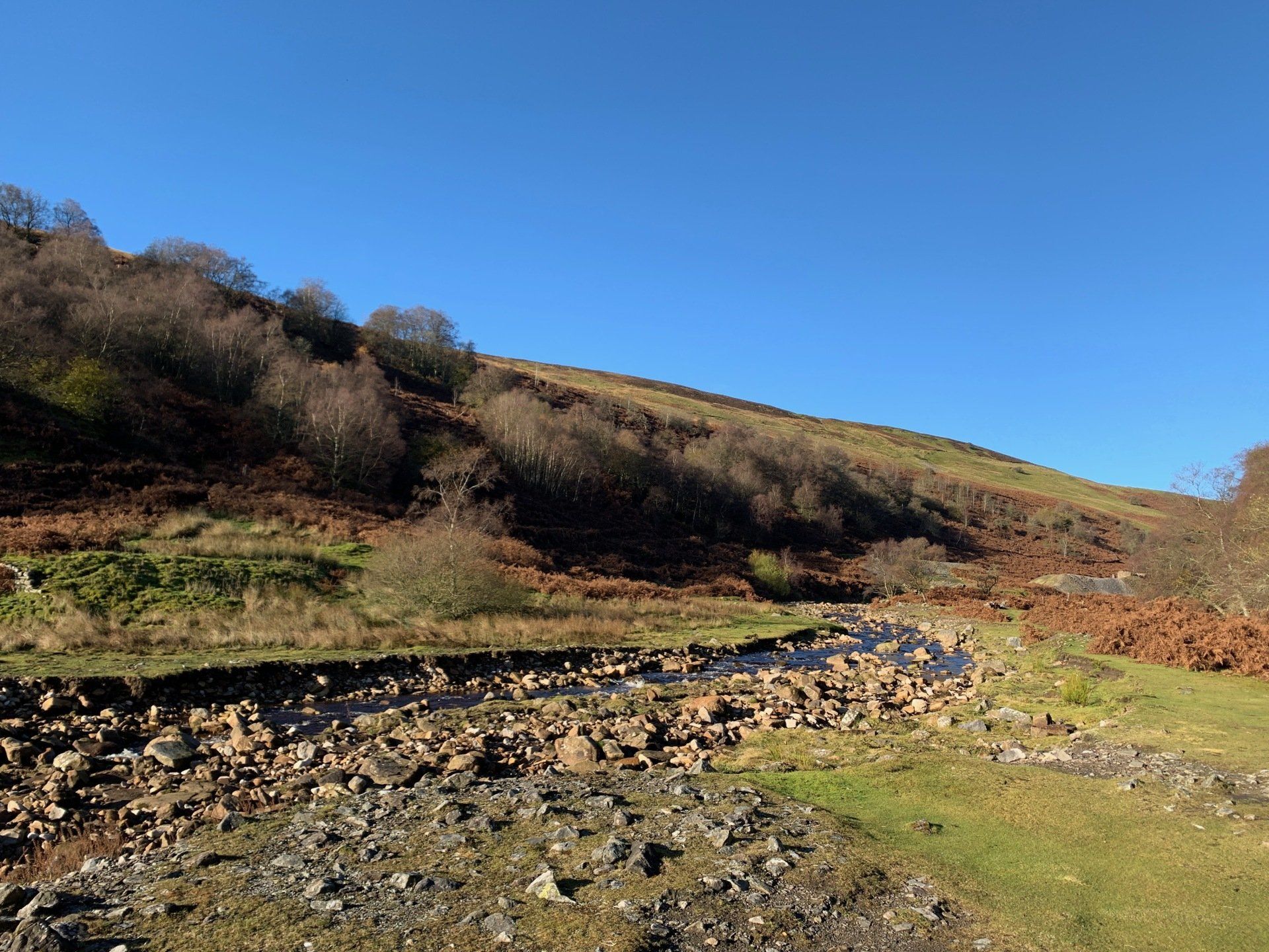
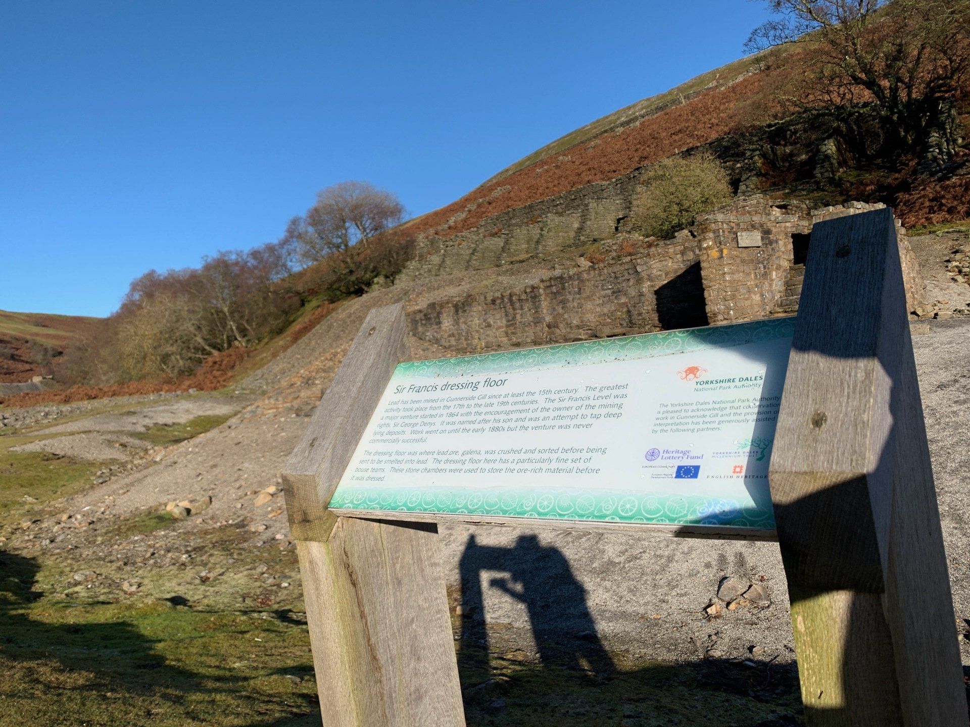
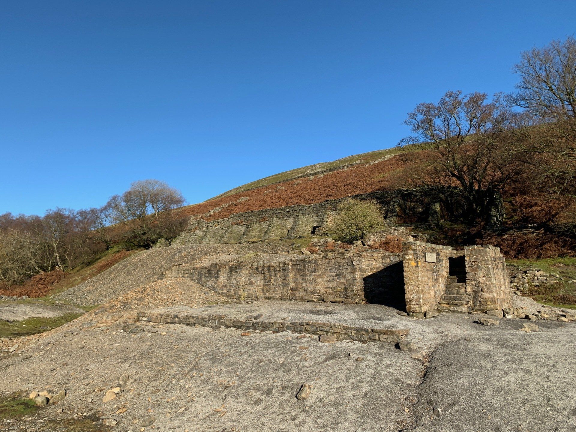
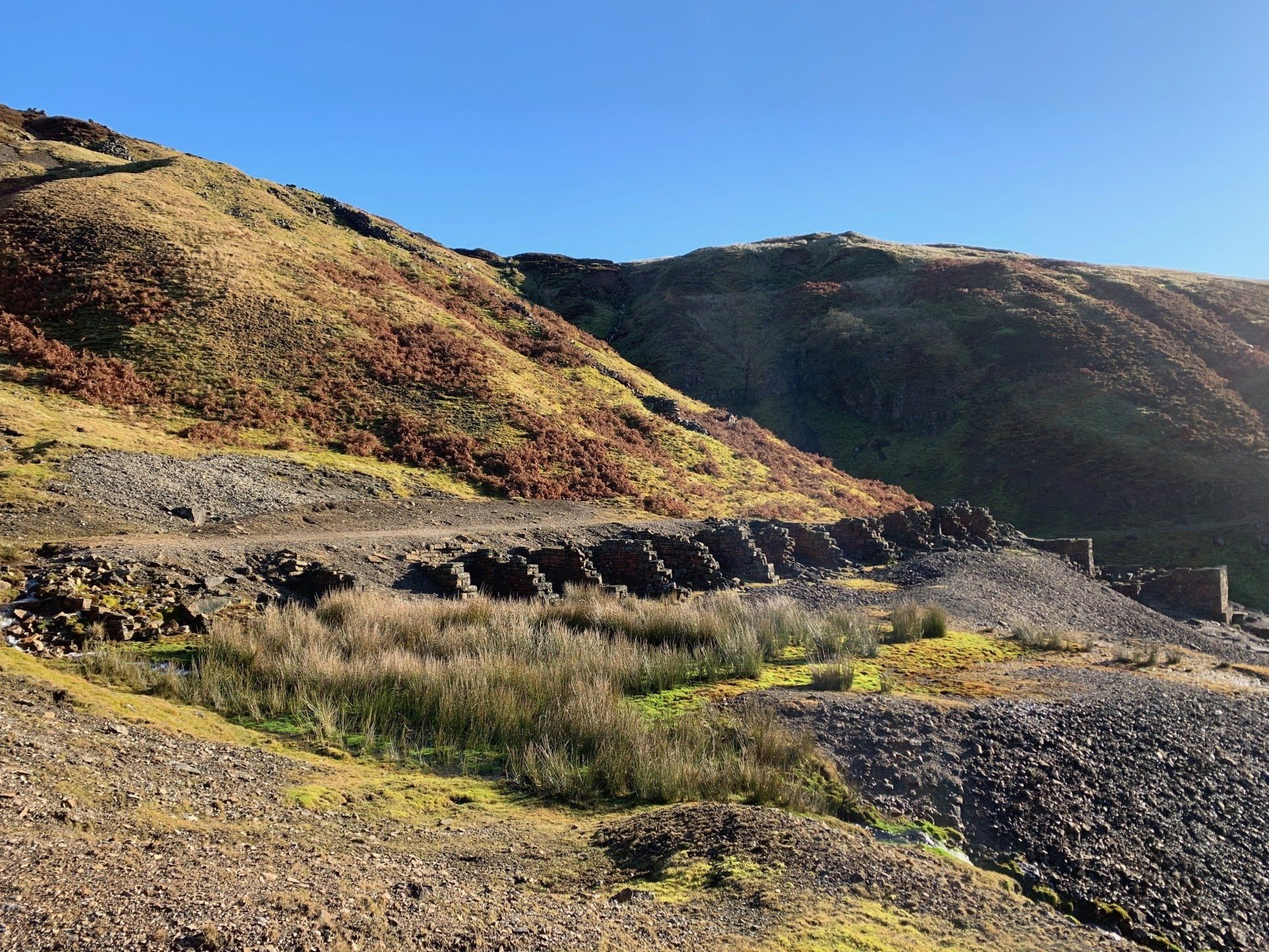
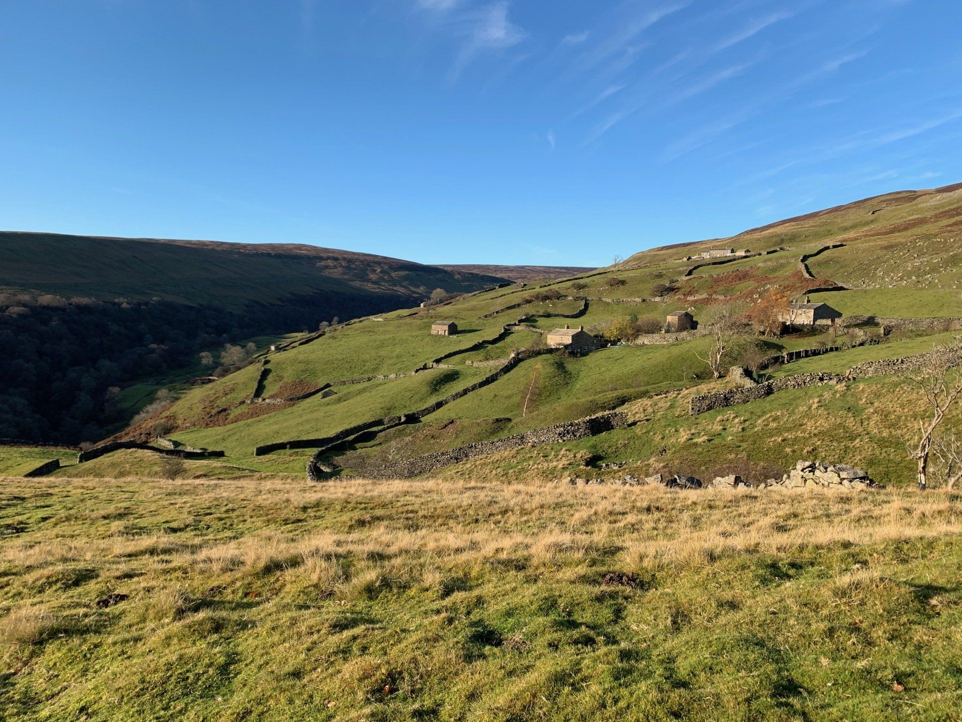
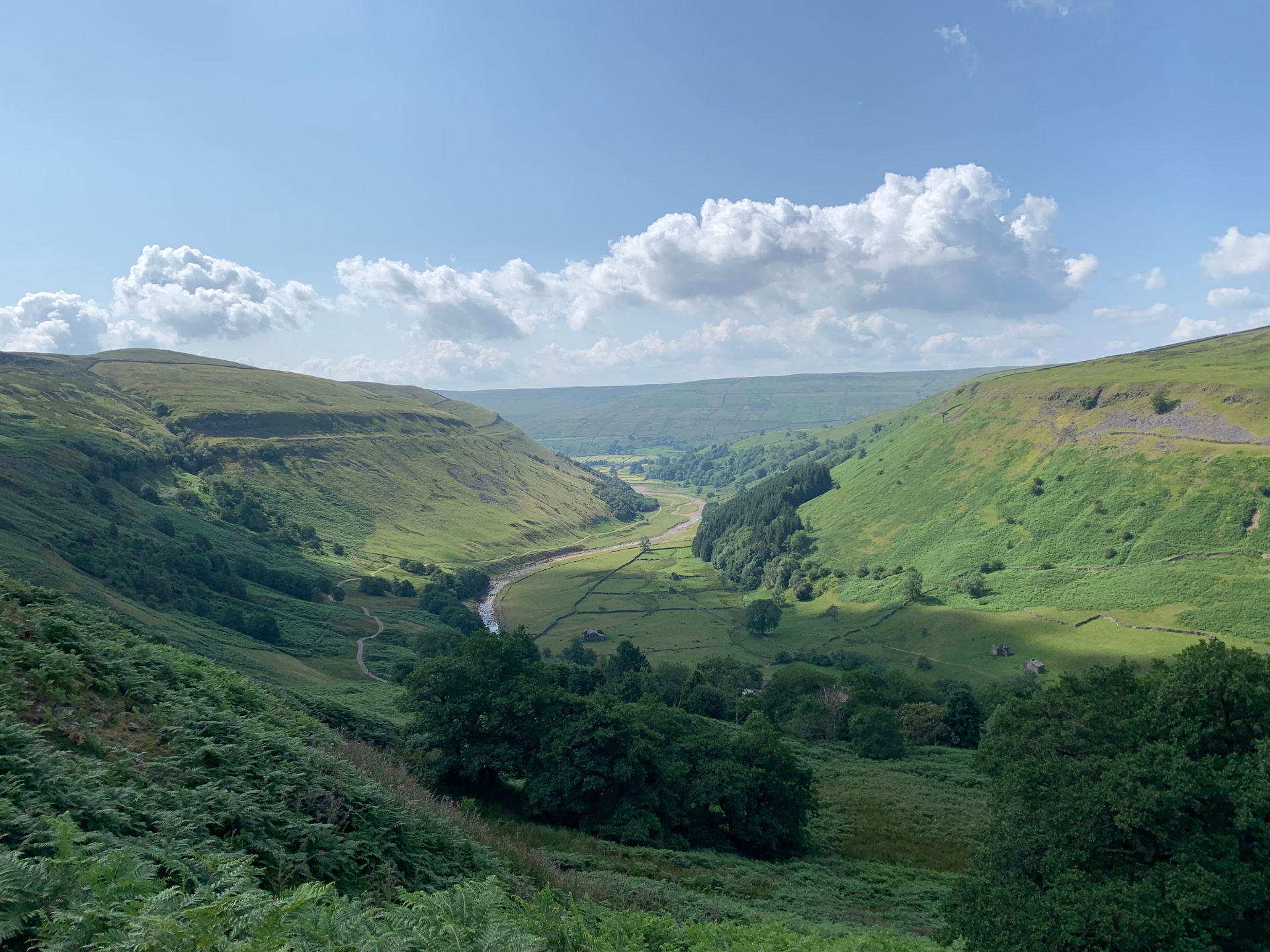
The footpath is easy to follow and I am up and out of the woods in no time. The land suddenly widens and opens up to flat grassland with rocky beck sides. A little further up we find the broken remains of so many lead mining buildings. “Sir Francis Level dressing floor” is the first one that meets us coming up the Gill. A stark reminder of the industry that preceded our time here.
From the flat down at the beck side, the footpath starts to climb higher up the steep Gill side. I’m now on unknown territory! A quick check of my OS Map and I see I’m still on the right footpath. I pass more broken down lead mining buildings, this time high up on the gill side, surrounded by spoil heaps. The other side of the gill is similarly dotted with old industrious buildings surrounded by spoil. Oh the stories they could tell~!
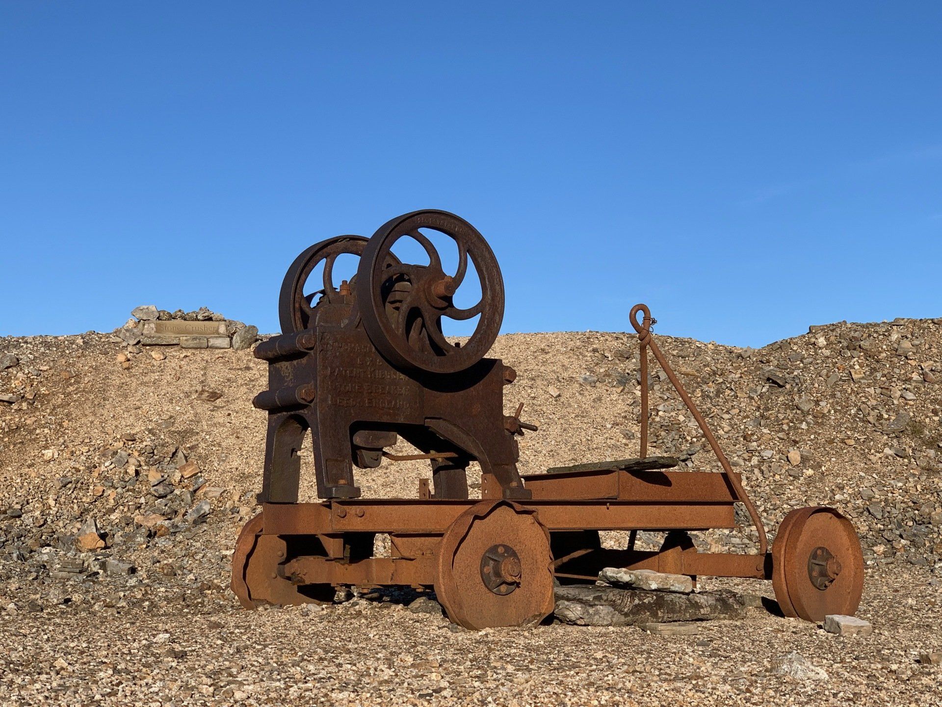
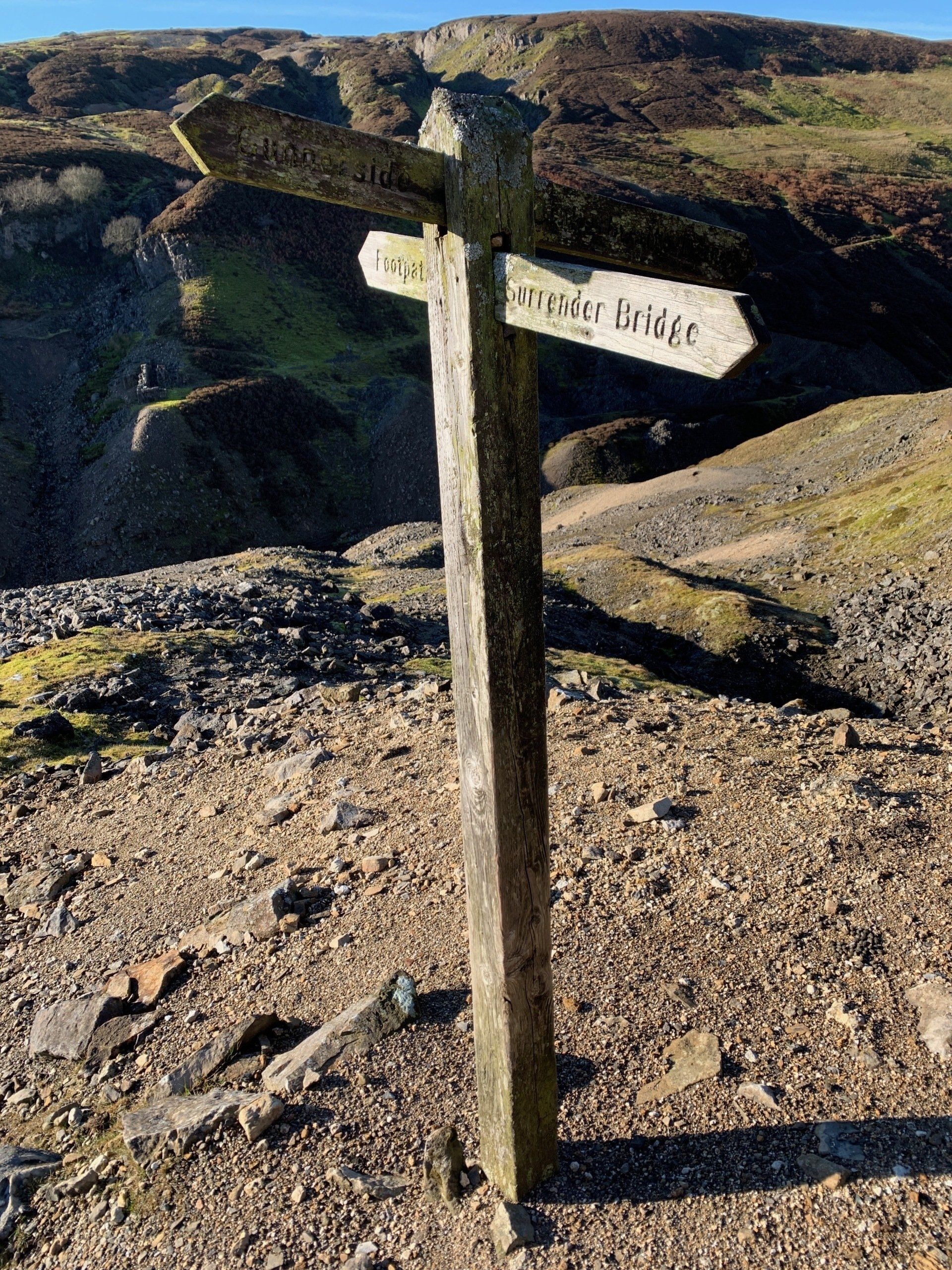
Here I find a 4 way footpath sign. Right then. Which way?! Out comes the app again. Straight on, heading up. Soon I am following a track that curves back upwards to the moor track. Yes! I know where I am! The app can go away again. I follow the moor track along from the top of Gunnerside Gill back down towards Melbecks and Merry Field. I love this little area, we came up here on our wedding day to have photos taken next to the old stone crusher.
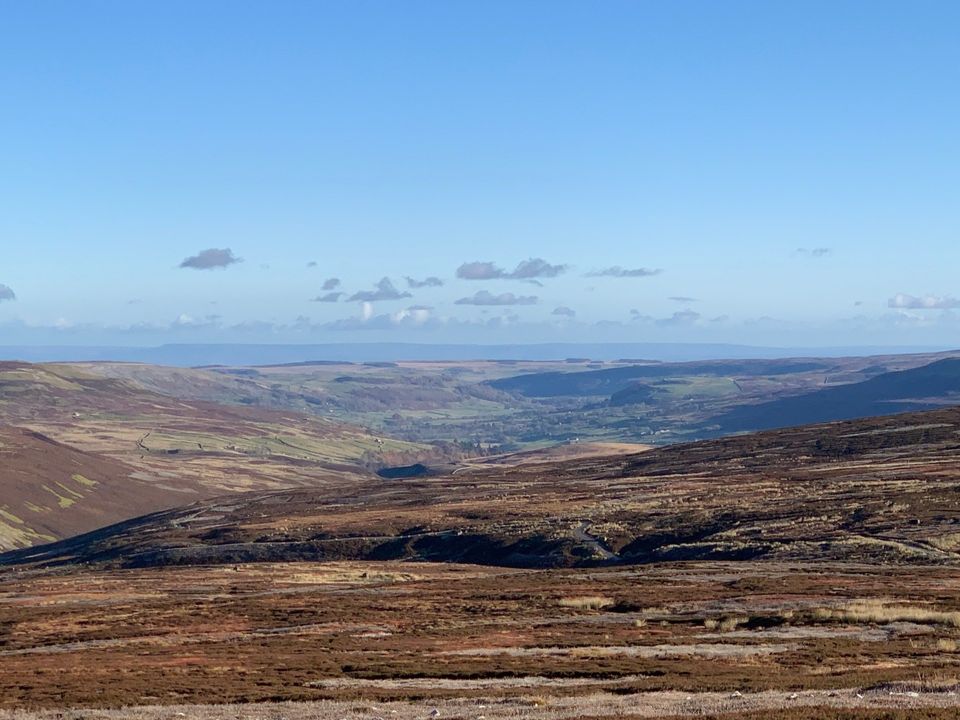
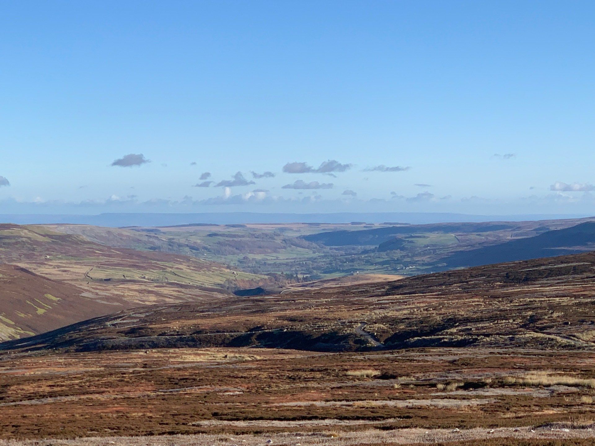
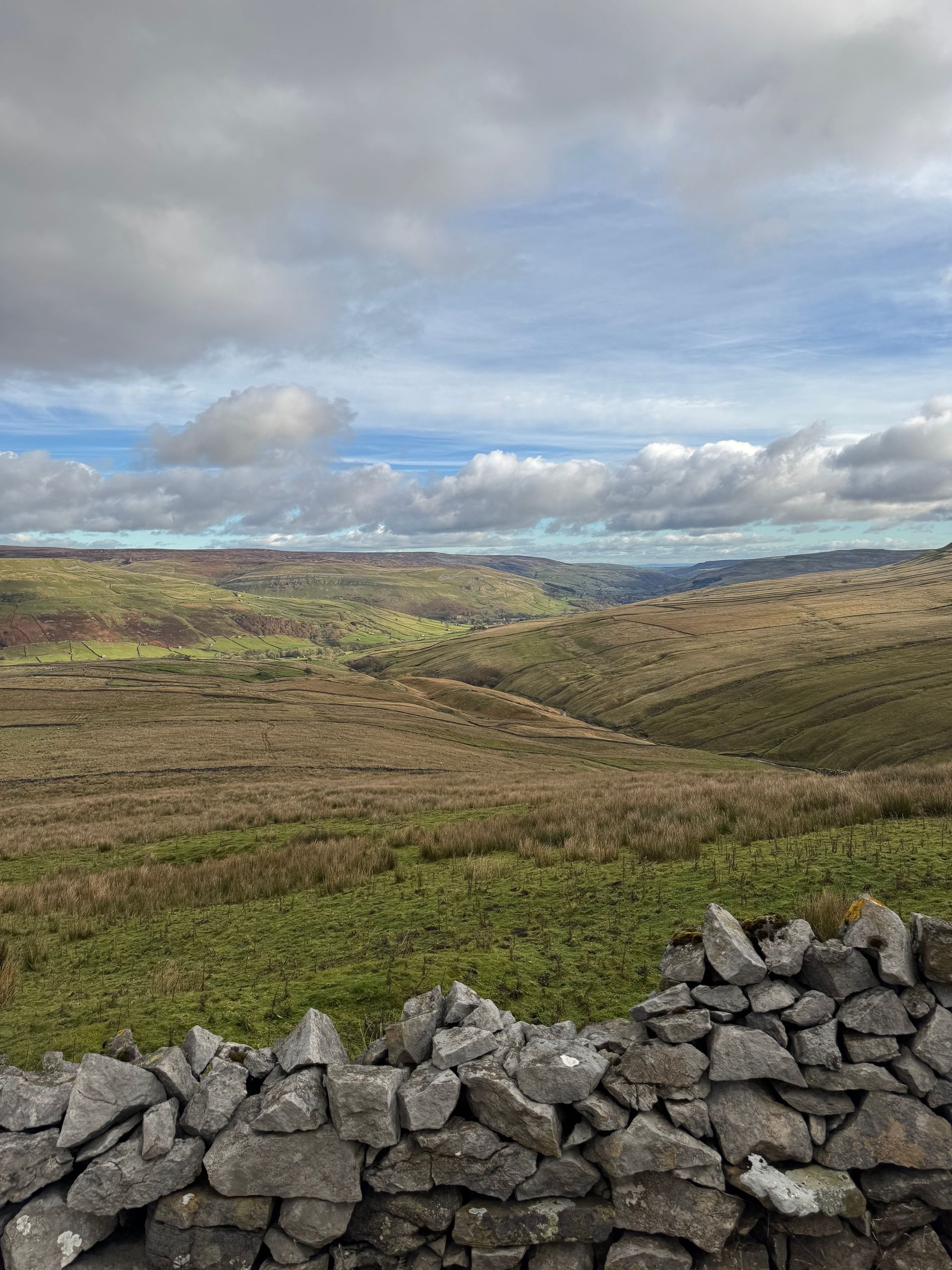
I follow the moor track and just past merry field grouse butts, take a right and follow the track through the sheep fold and onto Brownsey Moor. The view from here is the best on the entire walk. Just wow. What a day, what a view. And knowing that from here it is down hill all the way to the pub…
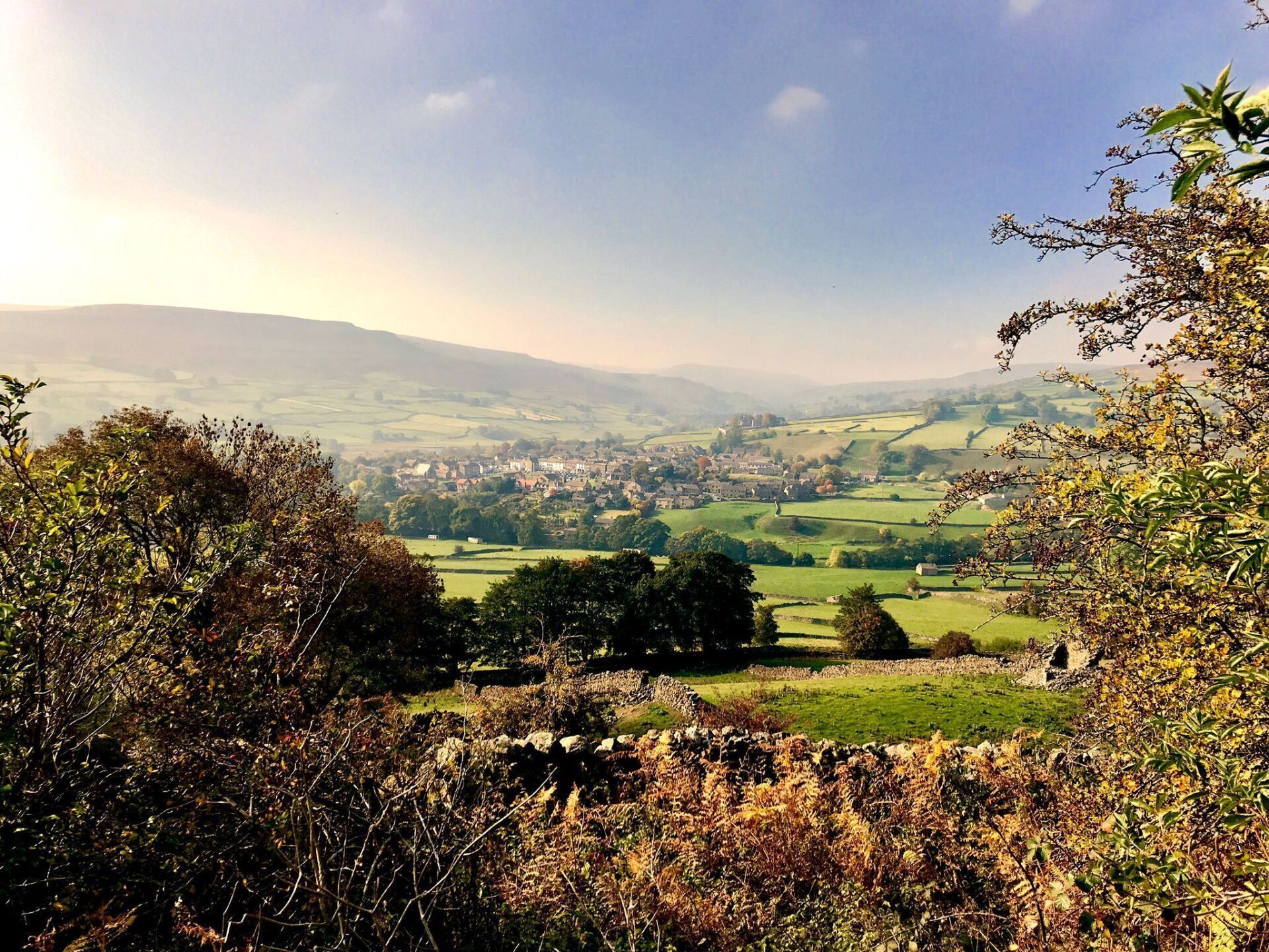
Another look at the app and I see its only 2 miles back to Gunnerside. But from here I can see Healaugh Crag, Old Gang lead mines and bulidings, Calver hill, Arkengarthdale, most of Fremington Edge, right down to Marrick Priory. I stand and take it in for a while. On a day like today it is hard to put into works how spectacular the scenery is up here in our beautiful little dale. It fills me with awe.
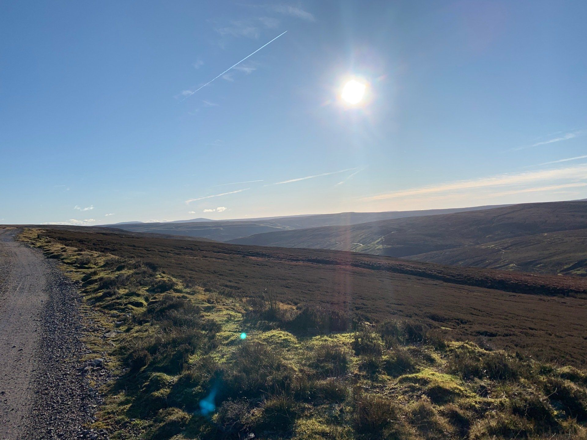
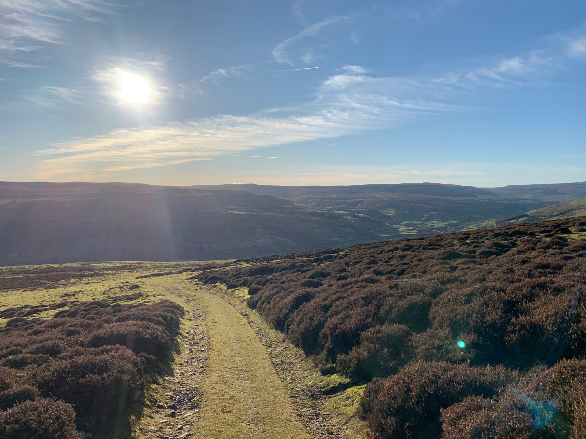
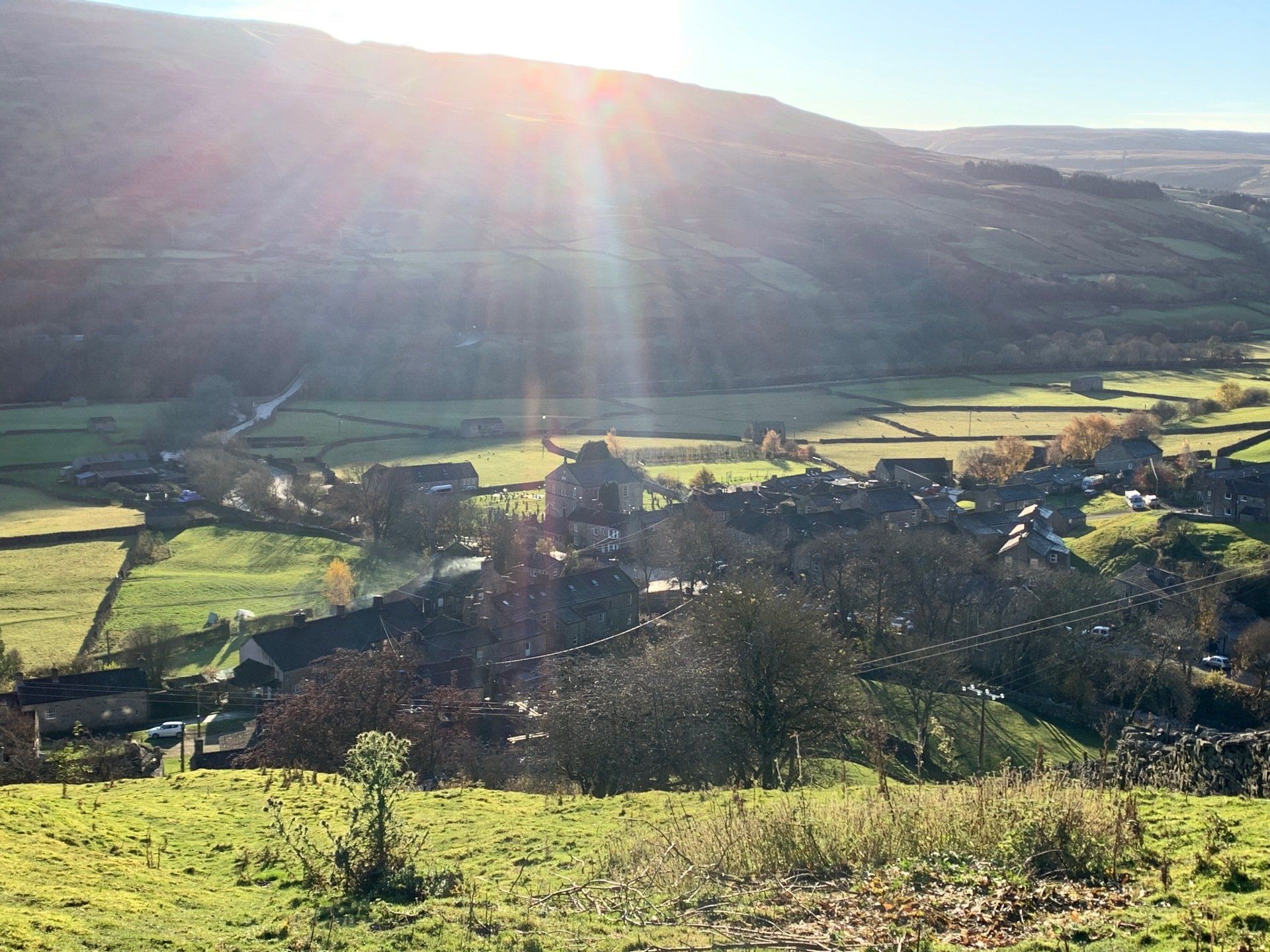
I stick to the moor track as it turns from a well maintained, hard core track to a grassy track that you can see has been used for vehicles but not for a long while. Nevertheless it guides me back down the hill side towards Gunnerside, sun beating into my eyes as I go. The sight of the village is a welcomed one, especially as I can see the only smoke coming from a chimney is at the pub… right where I’m headed for a hot coffee and a piece of cake.
The walk in total took me nearly 3 hours. I certainly wasn’t going fast, and was stopping to take the scenery in as I went. I wouldn’t say it was strenuous; gradually climbing for 3.5 miles on small, sometimes slippy footpaths until I got to the moor tracks at the top of the gill. From there it was much easier walking; and downhill all the way back to the village. If the walk was to be done in the opposite direction, it would be much more strenuous.
View more
A Perfect Dales Drive: Swaledale to Wensleydale (with plenty of stops along the way)
With the bank holidays coming up in May and the Summer Holidays on the horizon, we have put together a list of family friendly walks and activities to really make the most of your stay in beautiful Swaledale.

Happy New Year!

The most wonderful time of the year is almost here! Christmas 2020 was full of lockdowns and cancellations, so we’re definitely intending to make the most of the 2021 festive season. There are so many fun things happening in God’s Own Country this season – from artisan Christmas markets to spectacular light trails, Santa’s grotto visits and festive train rides, and so much more. Check out our guide below to discover some wonderful Christmas events taking place in the Yorkshire Dales this month…
Autumn is a truly wonderful time of year to visit the celebrated Yorkshire Dales. The Dales becomes an artist’s delight in the colder months, adding amazing autumn hues to its vibrant colour palette. Enjoy a stroll through the Dales as the leaves begin to fall or discover the county’s rich history in a quintessentially British castle, before curling up in front of a log fire in a hearty country pub. As the summer rush finally comes to an end, it’s the perfect excuse to get cosy in a luxury cottage this autumn. So, why not soak up the wonders of mother nature this season at Reeth Holiday Cottages?!
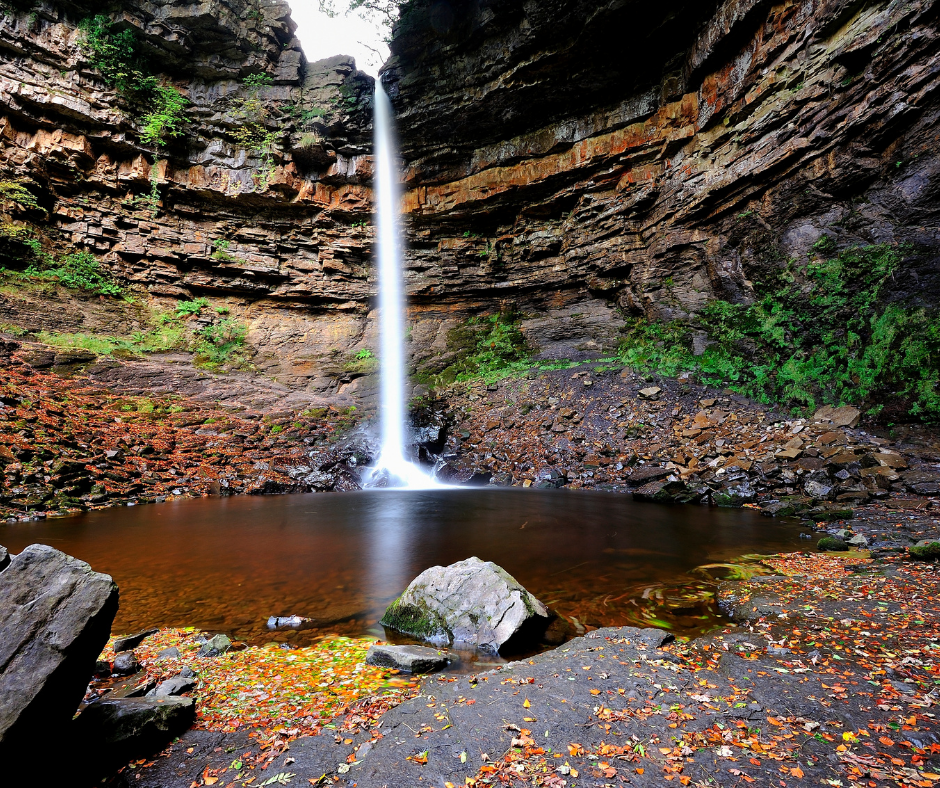
Have you been to visit the Yorkshire Dales yet? Our four luxury self-catering cottages are situated in the glorious village of Reeth, tucked away in the corner of Swaledale and Arkengarthdale. Reeth is a bustling hub of activity, perfect for exploring the celebrated Yorkshire Dales. Our cottages are extremely popular amongst walkers and visitors to the area. The Yorkshire Dales is one of the most picturesque areas in the whole of the UK and is arguably the waterfall capital of England. The county is awash with waterfalls of all shapes and sizes, with its dramatic landscapes boasting cascading falls. The Yorkshire Dales features the highest waterfalls in England both below and above ground, as well as the highest single drop waterfall in the country. We have compiled a handy list of our favourite waterfalls in the Yorkshire Dales; so you can spend less time researching, and more time exploring. All the below walks can be found on the OS Maps app, which guests can access whilst staying at our cottages.
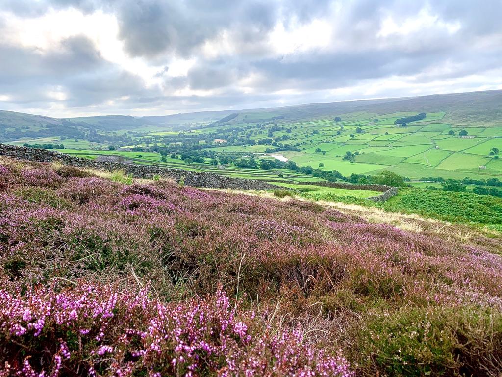
The annual grouse shooting season is one of the most celebrated events in the Yorkshire Dales calendar; beginning on the Glorious Twelfth (12th August) and lasting until 10th December. Moorland owners and gamekeepers of the Yorkshire Dales carry out vital conservation work on more than 226,000 acres of precious heather moorland across the area, many of which are designated Sites of Special Scientific Interest (SSSI). During the late summer season, our beautiful Dales moorland really is a sight to behold. The heather is in full bloom on our uplands, turning the hills a vivid purple. The heather provides the perfect habitat for the remarkable red grouse. Keep reading to discover more about our important work in moorland management…
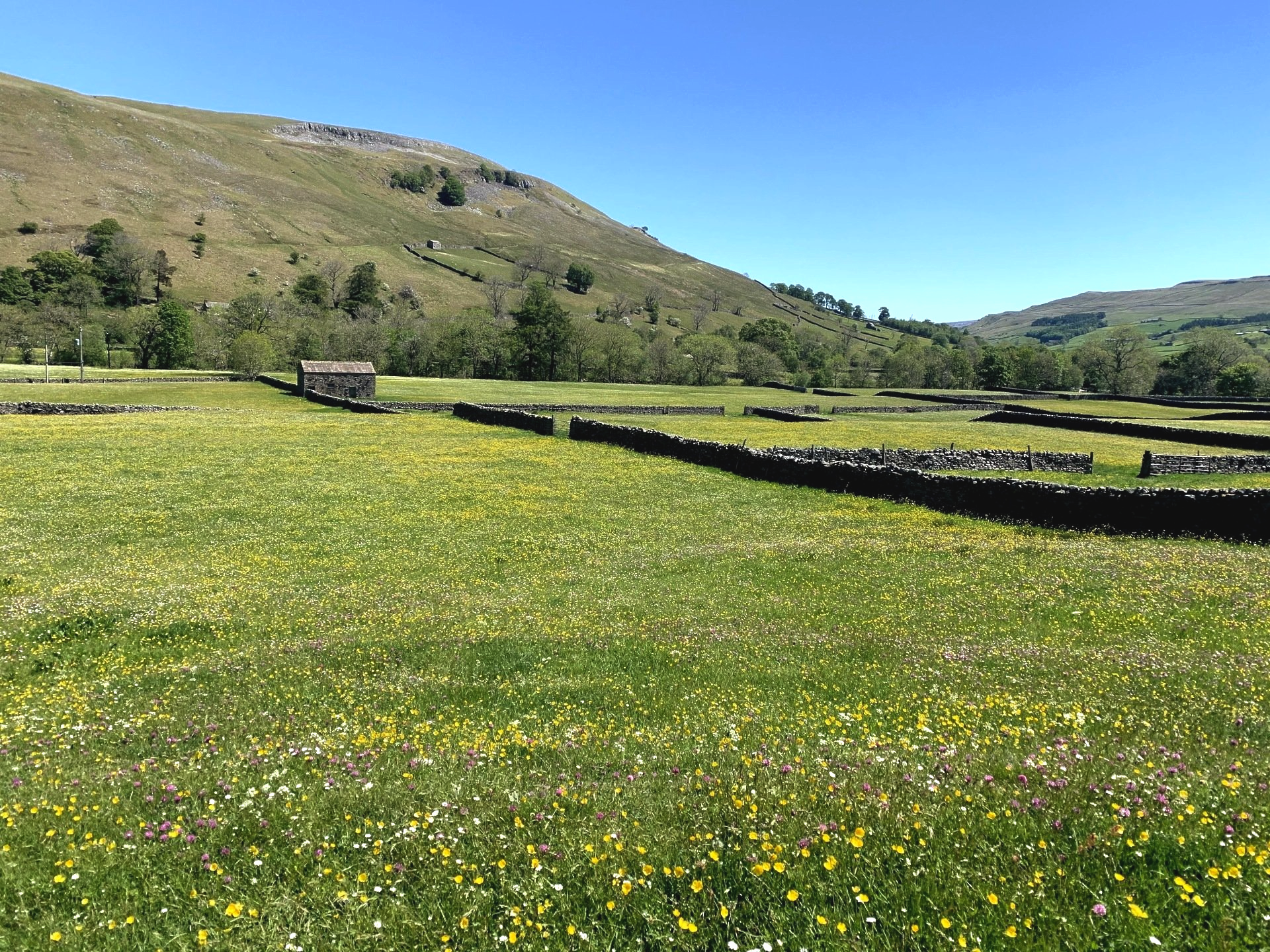
Nature truly comes alive in the Yorkshire Dales during the summer months. Birds and animals are hard at work feeding their young, whilst the spectacular hay meadows reach their peak. There is no finer sight or smell than a hay meadow in full flower on a hot summer’s day! Swaledale boasts some of the Dales’ finest hay meadows, which are best experienced in late June to early July. Keep reading to discover more about the Yorkshire Dales’ very own delightful hay meadows…
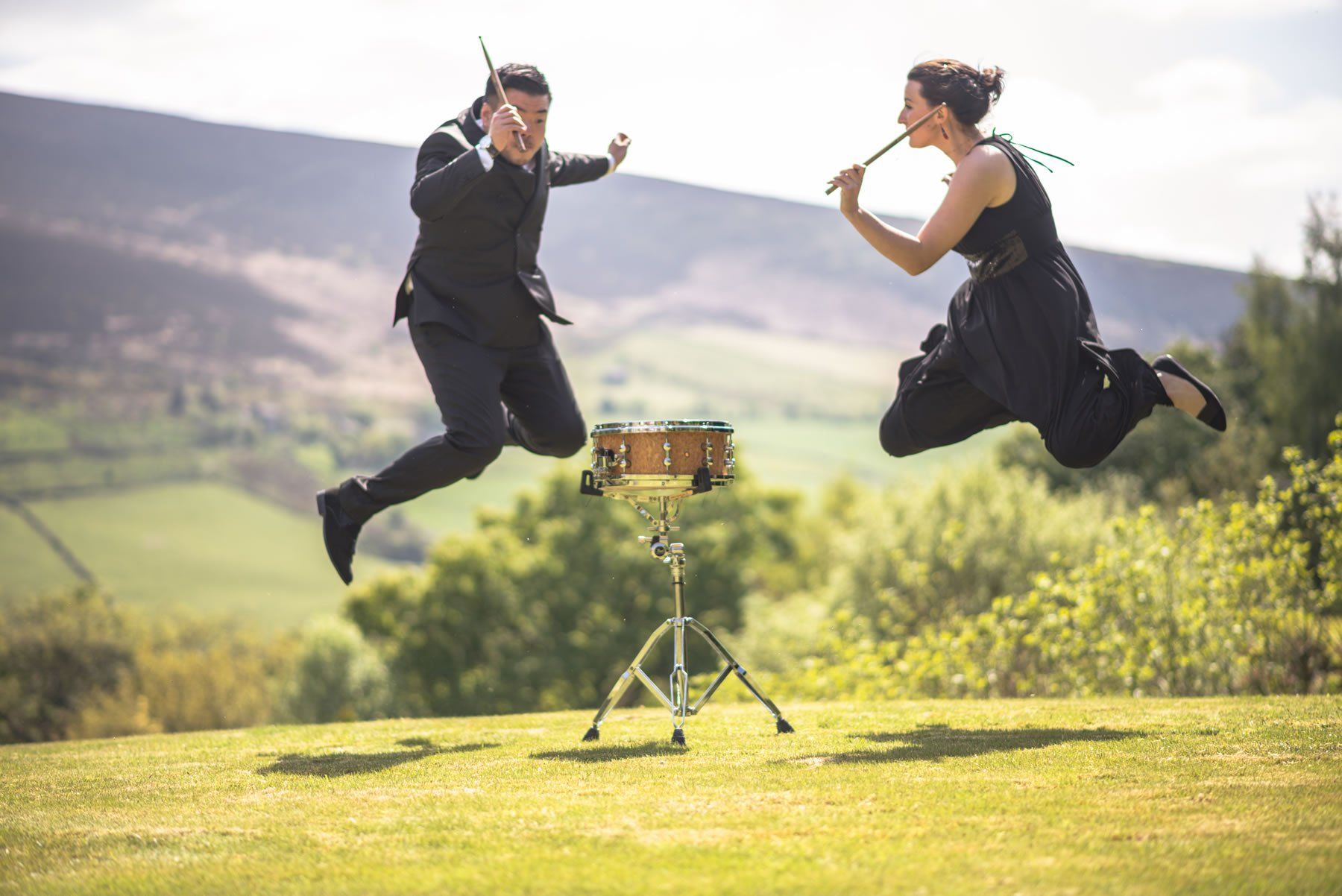
After being cancelled last year, we are delighted that the renowned Swaledale Festival has returned in 2021! This celebration of music and arts has been running since 1972, situated in the three most northern areas of the Yorkshire Dales: Swaledale, Wensleydale and Arkengarthdale. Beginning on the Saturday of the late May Bank Holiday each year, the festival boasts marvellous musical acts, artistic workshops, children’s events, guided walks and much more. This year, festival organisers have decided to spread events over a six-month period, instead of the usual 2 weeks. Many events have been so popular that they are already sold out, but there are still tickets remaining for the following…
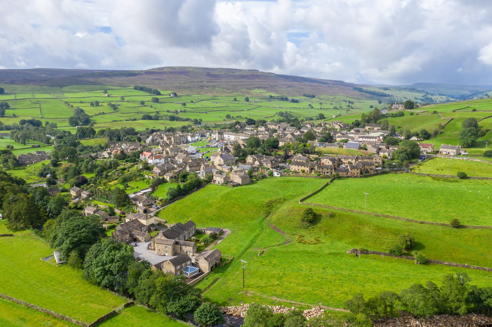
Tucked away in a cosy corner of Swaledale and Arkengarthdale, the picturesque village of Reeth is perfectly placed to explore the surrounding Yorkshire Dales. Visitors from near and afar flock to Reeth to explore the spectacular Yorkshire Dales landscape each year. The village is only a short two-minute stroll from our four luxury self-catering cottages and the community of Reeth is always bustling with activity. There are various pubs, restaurants, cafes, shops, a museum, a hairdresser’s, an ice cream parlour, a beauty salon, and a weekly Friday market to enjoy.